Colorado 14ers: Mount Shavano
The Deal
After a very successful climb of Mount Oxford, I decided it was time to try something ambitious: a whole week of climbing Fourteeners. As I knew, there are several clusters of them: the Front Range and Sawatch ones were easy to climb from Denver; the Elk Mountain ones were all too hard for me at this point; a cluster in the South comprised the Sangre de Cristo Range; and the final cluster were the San Juan Fourteeners, some of the most beautiful landscapes on Earth.
The plan was simple: drive through Taylor Park (research for an upcoming novel) to Lake City, stay there for a week, and climb the Fourteeners there (I picked Uncompahgre, Handies, Redcloud, and Sunshine, left out Wetterhorn because it’s a Class 3 climb). Then, on my way back, I would complete the Sawatch Fourteeners by climbing Mount Shavano and Mount Tabeguache, two twin mountains that close the range to the South.
Sadly, the weather did not cooperate. The endlessly long and dry July gave way to a much wetter and more typical August, and I canceled the trip. But I knew I could reach Shavano from Denver, although it would be a long drive. So why not go for it?
The Drive
Unlike with the previous 14er, Mount Oxford, I decided to day trip. Mostly, that was because I didn’t know until the last second if I was going to drive. It was Labor Day Saturday and I was afraid it was going to be super-busy. Also, the directions to the trail head made it seem like there was a good risk the trusted Impreza was going to be unable to get anywhere close to it. Another hiker mentioned they had had to hike 5.5 miles to the trailhead, and that didn’t seem fun.
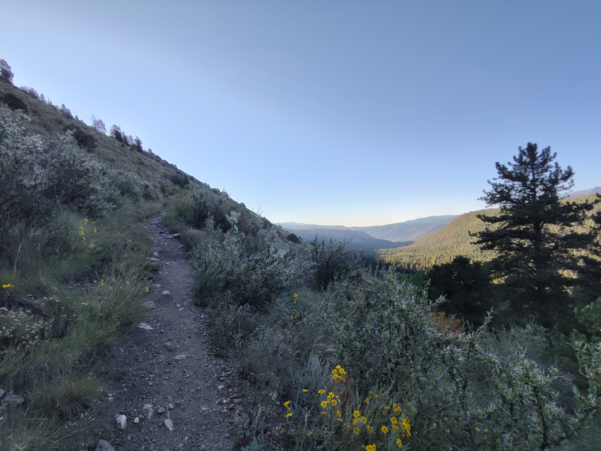
On my online scouting, I found an alternative to the regular trailhead. There was a campground just South of the main starting point, and a section of the Colorado Trail connected it with it. The distance was a solid 1.6 miles, and while that would make the hike longer, the drive would be much more pleasant, as there was no requirement to drive off-road.
In the morning, I decided to brave it. I woke up earlier than expected (4a) and packed up. I left around 5a, still pitch dark. I hit US 285 with minimal traffic, as it was too early for tourists and too weekend for trucks. The drive went famously and I was at the parking lot at around 7:30a, just as Google predicted.
Incidentally, there was a section marked as unpaved on Google Maps, but it was much shorter than marked, and the road surface was perfectly even. A great start to the hike.
Colorado Trail
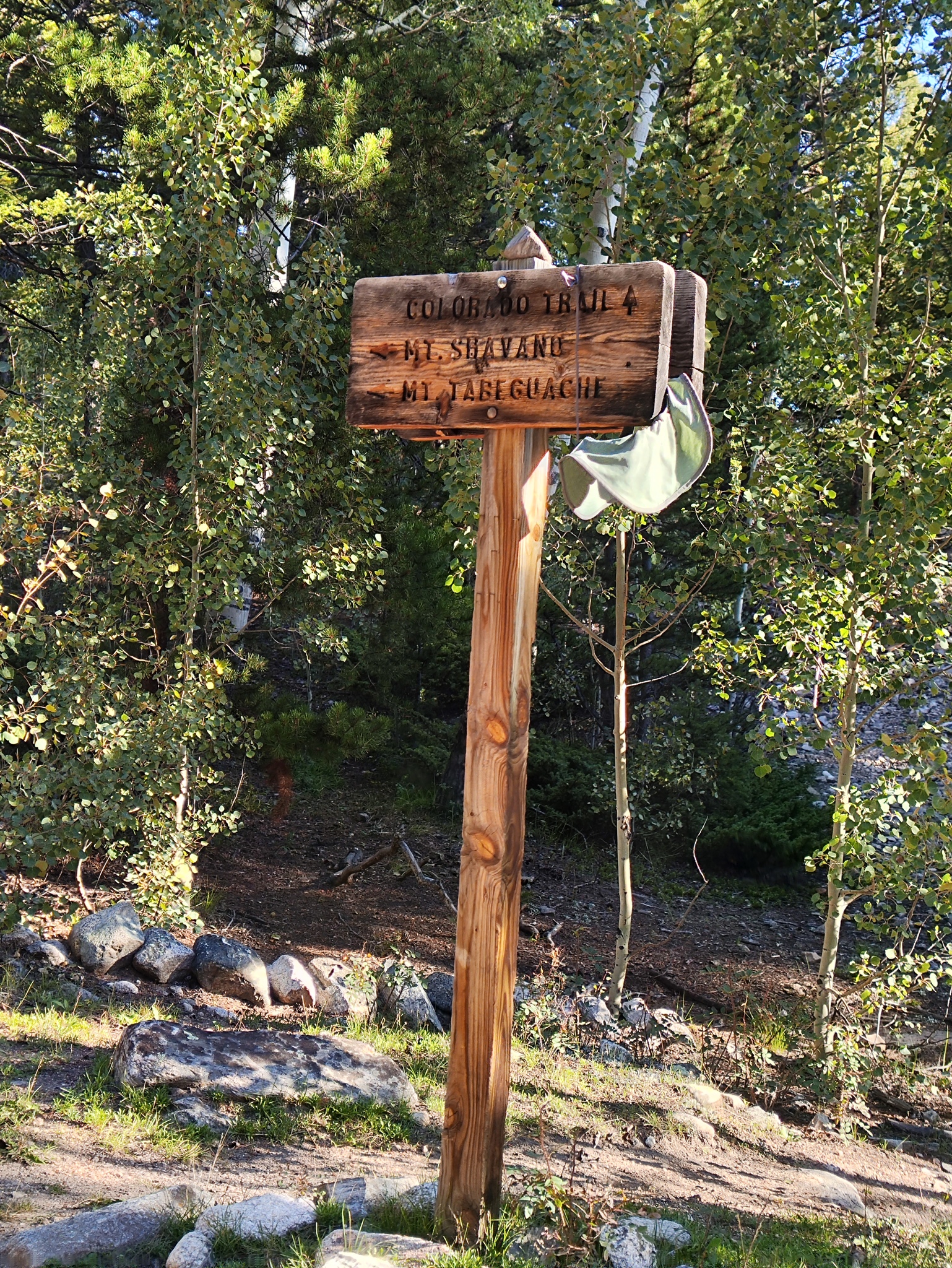
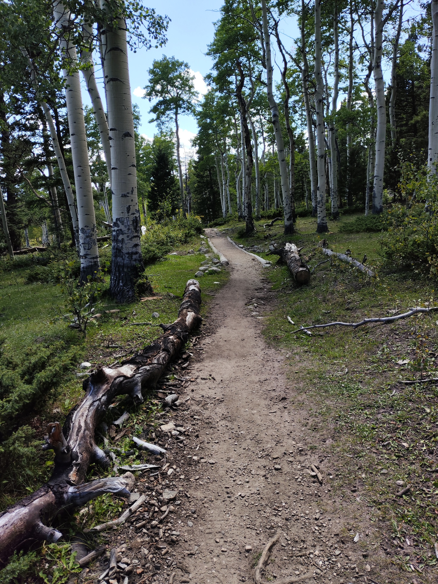
The initial part of the trek was going to be a challenge. I would have to ascend a 500 foot ridge, hike through a forest, and connect with the trail up Shavano. For a quarter mile, the trail from the main trailhead would join the Colorado Trail, so I should have an easy time telling when to turn, given the pictures from 14ers.com.
The initial ascent was incredibly pleasant. The ridge trail was straight and even, much less steep than the 14er climb later. I would recommend it to anyone thinking of climbing 14ers as an introduction: if you can’t or won’t make it up this trail, forget about 14ers.
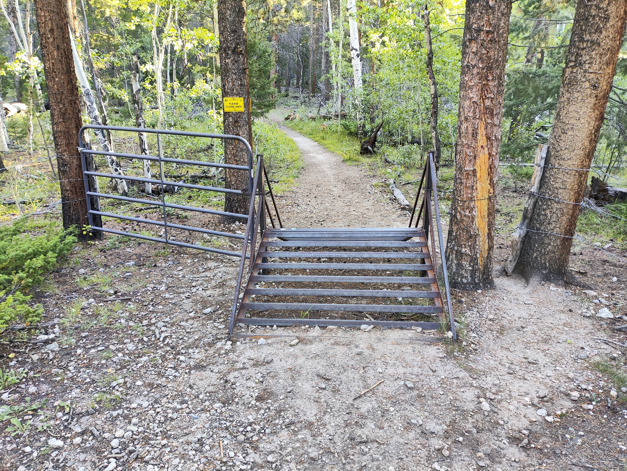
After hitting the top of the ridge, the trail descends a short while and is interrupted by a very strange cattle guard. Instead of being flat to the ground, it ascends and descends in a triangle shape. I wondered what kind of wild beast they were trying to keep behind the guard, and which side was being locked out.
Then I hiked and saw plenty droppings on the trail. They looked like cow droppings and I wondered what it could be. Moose, maybe? Definitely not deer, those I would have recognized. I wondered what bear droppings look like and realized that this particular section of forest and trail looked exactly like the kind of place where bears would attack you.
I moved on, slightly wary of the environment (for the final verdict on what the droppings were, read to the end), until I hit a forestry road (#254). That was not the trail to Shavano, I saw when checking the map on the phone, but it was getting close.
Mount Shavano Trail
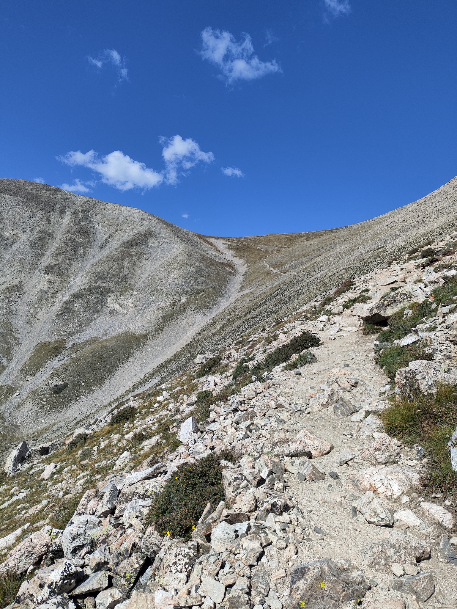
After a short and incredibly beautiful hike along this section of the Colorado Trail, the trail to Mount Shavano peeled off to the left. It was immediately rocky, as if someone had dropped off boulders just to make sure everyone knows this is no picnic.
The trail goes up in the forest. It’s not very steep, at first, and easy to navigate. After a while, there was a giant white tent to the left, marked as belonging to the Fourteeners Initiative (14ers.org).
The forest continued and the trail with it. It was pretty busy with people coming down (I counted 31 crossing my path to the summit), but everybody was very nice (if some oddly continued marching, ignoring my priority; I guess not everybody knows how to hike). In all honesty, the trail was pretty dull, climbing up a narrow gully with a view of a deeply eroded mountainside with dark gray rock.
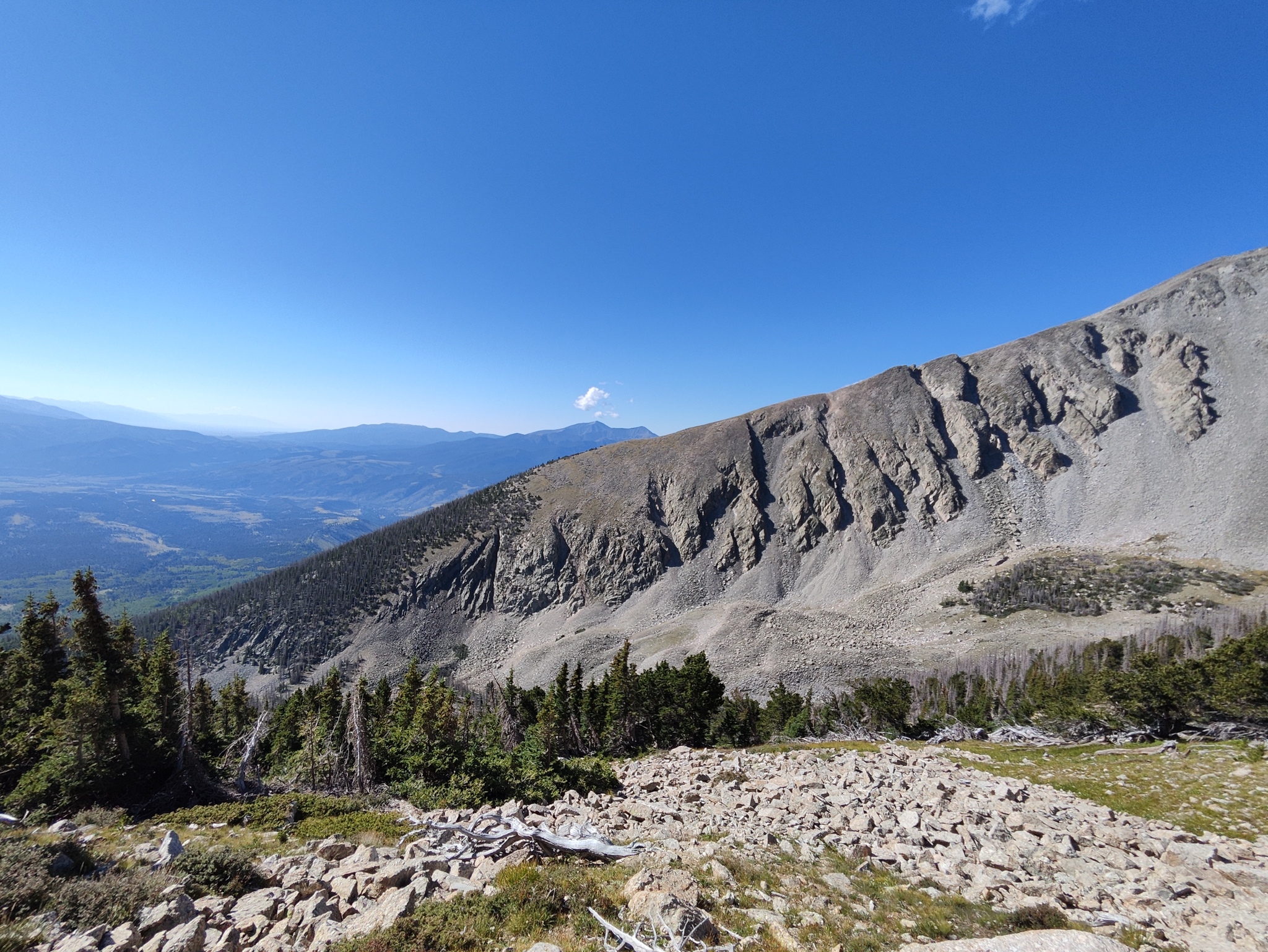
The trees became thinner and thinner while the trail was perfectly visible, climbing into the gully towards a ridge. Eventually I hit the treeline and the trail extended ahead of me, almost infinite. I climbed and climbed, and there was nothing to look at. Dirt and rock, no trees or flowers. A pretty dull section.
Eventually, we reached the saddle. The broad ridge afforded great views of the summit, of Mount Tabeguache in the back, and of the Arkansas valley behind us. A short flat hike was followed by the summit ridge, which was all boulders.
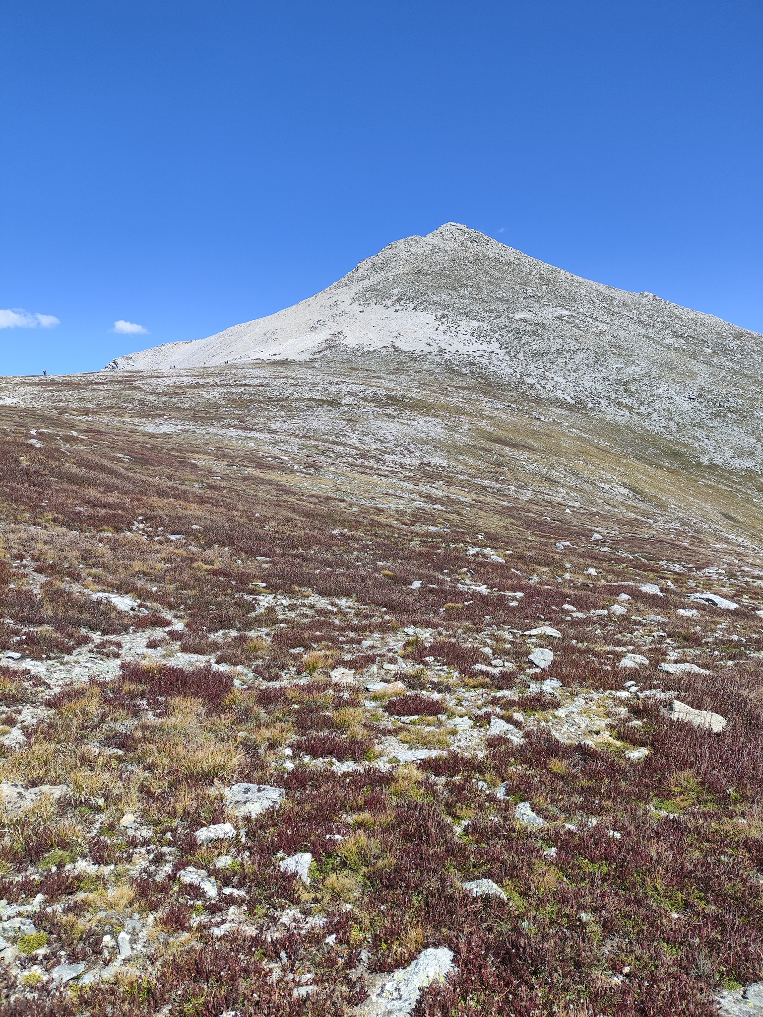
Things got a little dicey here. I recalled the trail description on 14ers.com saying you should follow the main, most established trail, but there was no such thing. You pretty much had to figure out how to climb by looking at the rocks ahead. There were no cairns, there was not visible trail finding, and people were going up and coming down from all sides.
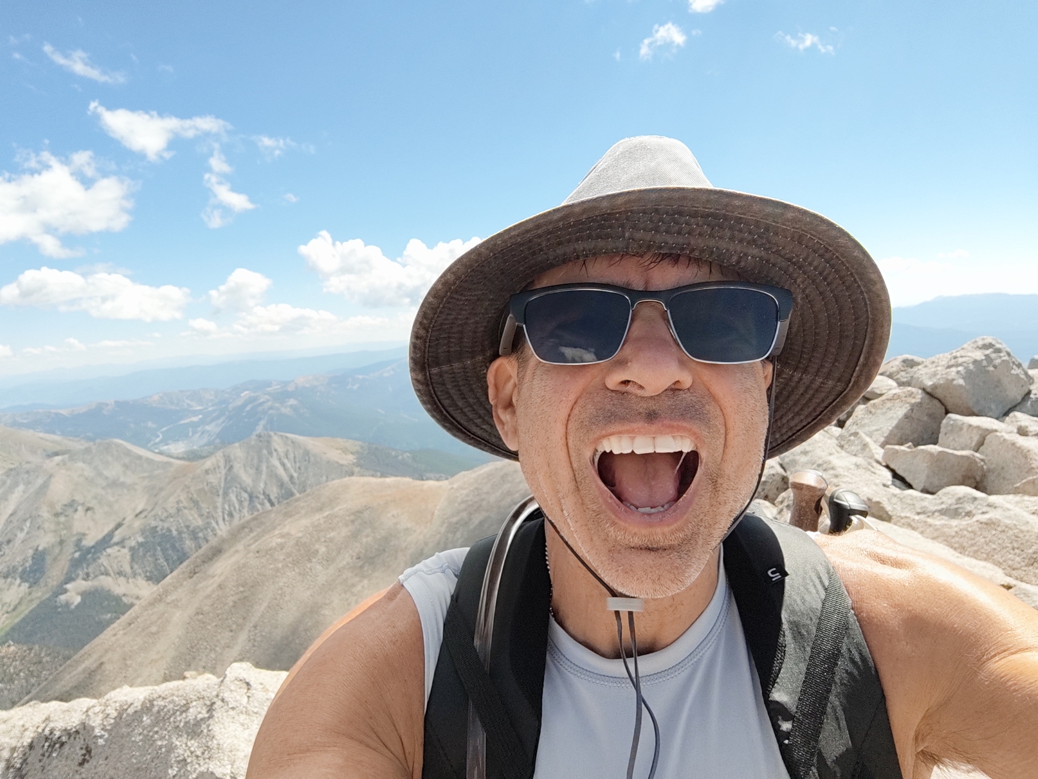
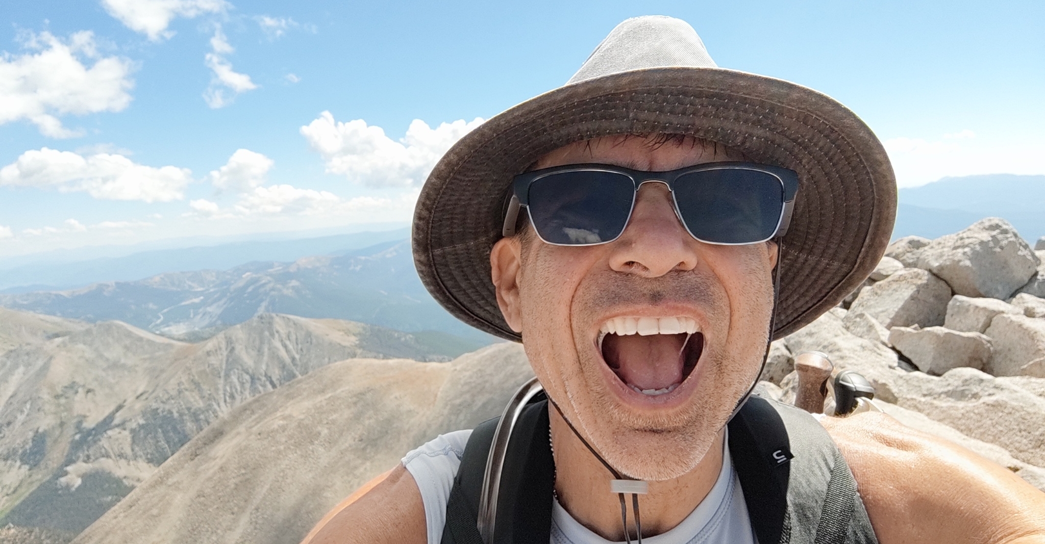
Eventually, I figured out a route and got to the summit. Three bros were lounging there (why don’t bros ever lounge off-peak?). I got my summit selfie and moved away, already realizing that it was unlikely I’d hike to the next peak.

While eating my lunch (summit sandwich, of course, this time frittata, pepper jack, and chicken breast), a bunch of people showed up. We all chatted affably, and it turned out that a group was heading to “Tab,” as they called it, since people seem to have a problem with pronunciation. I wondered if I should join them, but I was prey of the Curse of the Shorter Fourteener, which consists of looking down from the taller one and thinking it stupid to hike for an hour just to get to some place that is below where you are right now.
In hindsight, I should have probably gone. The ridge that I had just climbed was much steeper than the one towards “Tab,” and the ridge to Tab was not too hard or long. The two mountains barely clear the 300 foot vertical separation required to be recognized as separate Fourteeners, after all.
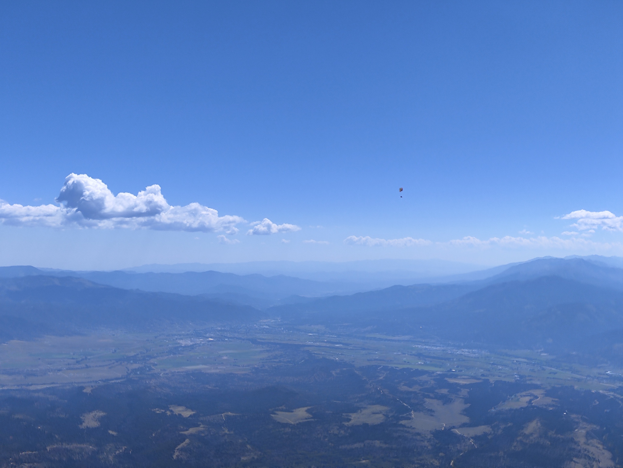
As it stood, we all got to see a group of five paragliders come in from the side and use the thermals to soar high above us. It was incredible to see them, especially because they came out of nowhere and we wondered if they had gotten a lift from a plane or had started lower and gotten high up just with their incredible skills.
The Descent
I stood up and extended the hiking poles to the max, then started hiking down. It was pretty much a reverse of the ascent, only that from above, the trail was even less visible and I got stuck hopping boulders that were clearly not meant to be part of a trail a few times. It felt a little like the traverse from Columbia to Harvar, or the middle section of La Plata.
It was relatively early, barely past noon, but the trail was already emptying. I found that odd on Labor Day weekend, but welcome. I hopped and marched, going much faster than I thought possible. I hit the merge with the Colorado Trail and turned right.
During the march, I suddenly started hearing moos. I wondered what that was, then saw a big black cow on the trail. She eyed me very quizzical and territorial and I decided while she was probably human-placed, I should not assume she would be human-friendly. At least, I knew what the droppings were, something I thought about as I crackled my way around the cow through the brush.
I hiked, looking back to see if the cow was still mad at me for using her trail. Eventually, I hit the forestry road again, then a group of ladies that were looking for the parking lot. I marched on and hit the cattle guard, then the descent to the car. I eventually made it, drank a few bottles of water, and headed back home.
Traffic back was absolutely atrocious, mostly because so many tourists were on the road. Nothing against them, but many of them are unfamiliar with the roads, and mountain roads in general, so they tend to drive extremely slow in turns. That wouldn’t be so bad, if they then didn’t decide that nobody is allowed to pass them in passing lanes, and they drove 20 or 30 miles over speed limit in them.
I got back all in one piece and was happy that I had done the hike. But, at the same time, this particular mountain is not on my list of Fourteeners I would hike again.